Hiking trail "La Mistrale"

-
Randonnée "La Mistrale"
Panneau info rando
26600 ÉRÔME - Contact by email
- +33 4 75 08 10 23
- https://rando-ardeche-hermitage.fr…
Itinerary
- Distance:
- 12 km
- Elevation:
- 694 m
- Daily duration:
- 4h 41min
Description
Good differences in elevation for this tour by the old pathand the viewpoint of Serves.
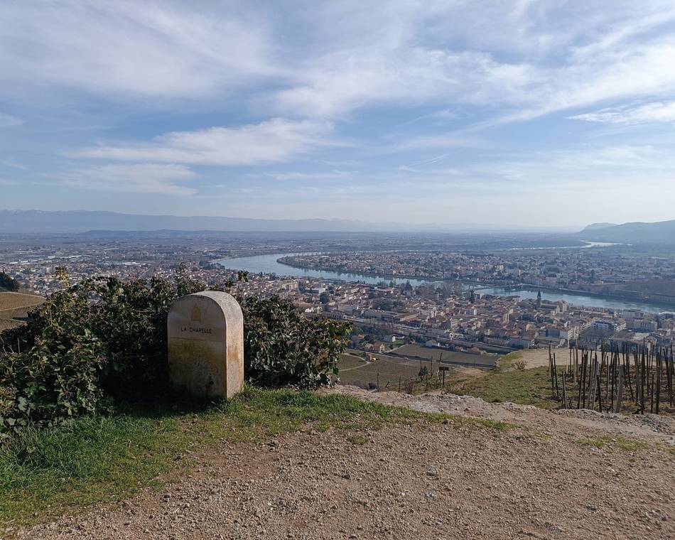
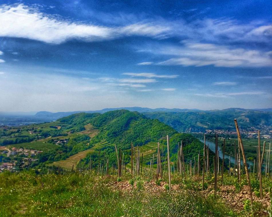
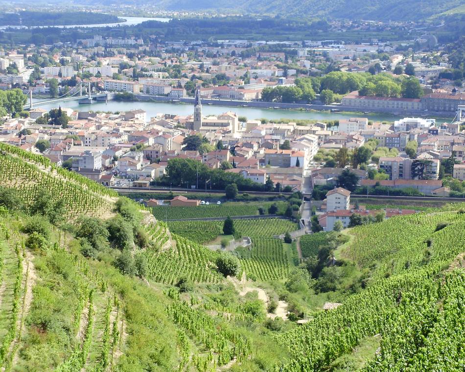
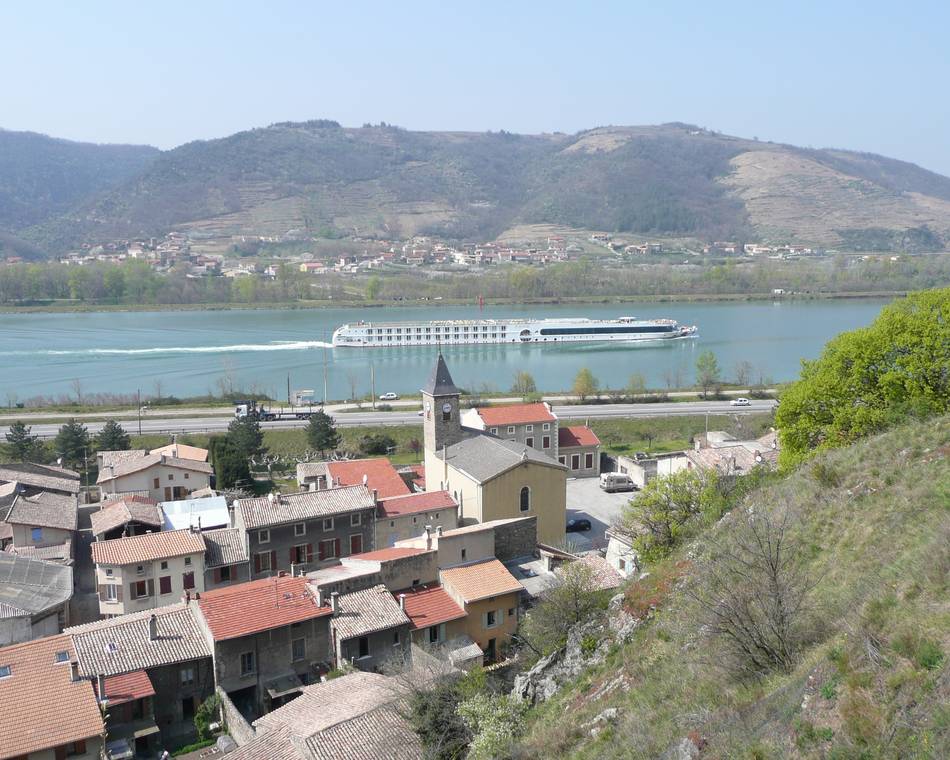
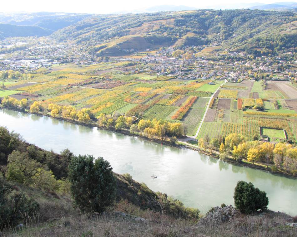
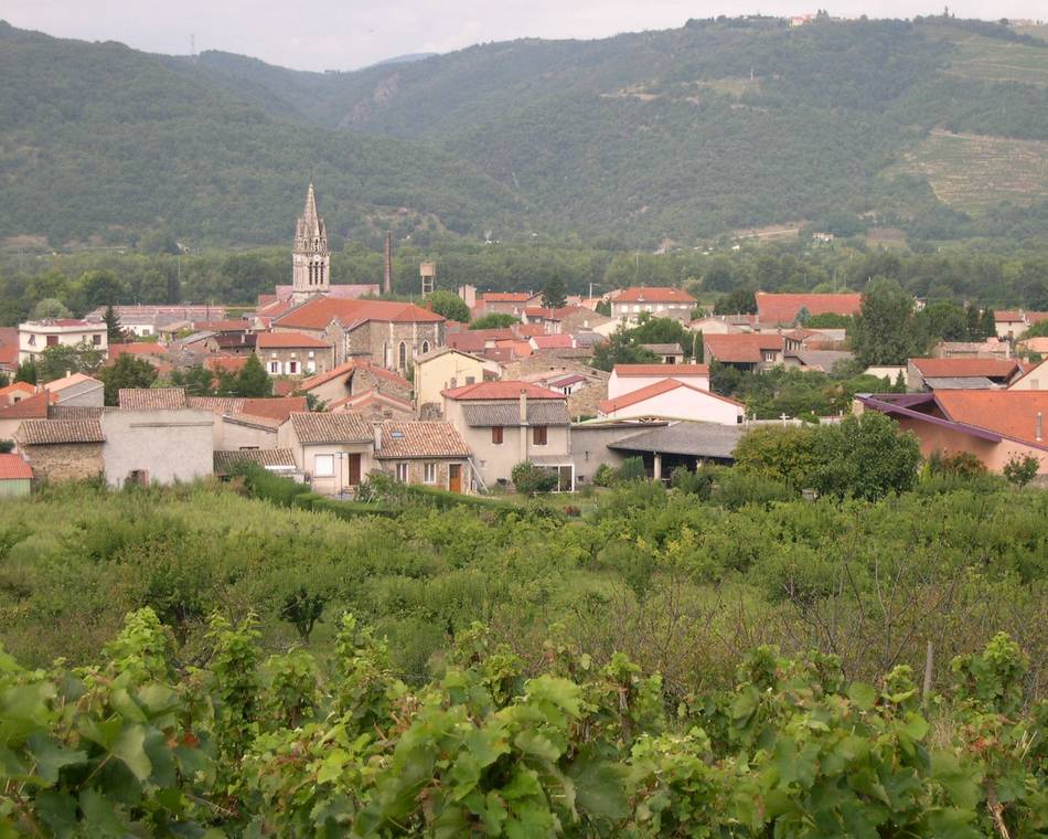
Magnificent panorama over the Rhône valley, the mountains of Ardèche and even the Vercors.
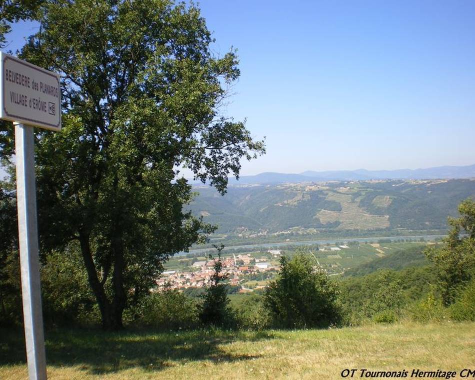
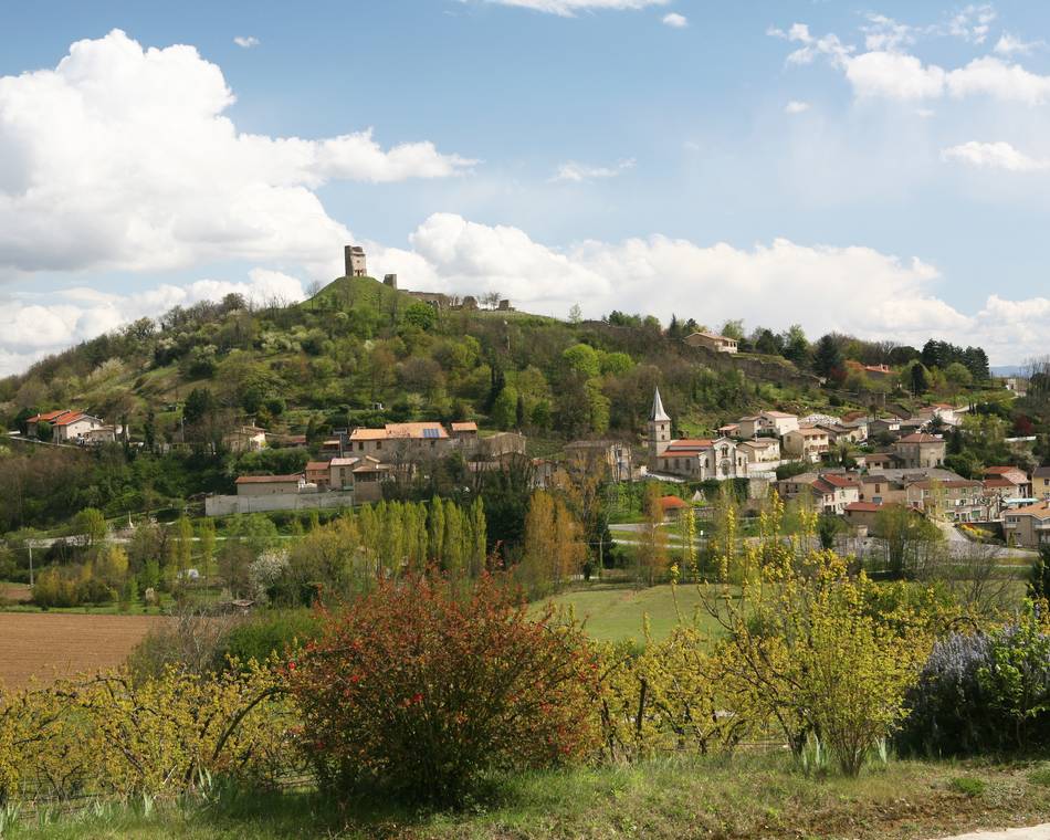
Start from a narrow street above the Salle Héramen parking lot. After 300m, on your right is the sign for the sanctuary of the three crosses. On a small path, you have a few steps to climb, and here you are in front of a majestic, two-hundred-year-old oak, listed as a "remarkable tree". After this visit, continue up the asphalt road for about 350m, leaving on your right a large water reservoir used to irrigate crops on the plain. Climb another 50m and take the first dirt track on your left, which descends towards the Route des Planards. In the middle of the descent, there too stands a magnificent oak, also a "remarkable tree". At the bottom of this descent, turn left onto the tarmac road for 250m, and at the bridge, take the "chemin vieux" on your right. After about an hour's gentle climb through the undergrowth, you'll come to a number of houses. Turn left and keep heading north for 700m, turning left again after a house on the edge of the tarmac road, then further along a dirt track (a panoramic descent over the vines). Walk along the railroad line, then up the stream for 10 minutes. Take the path on your right, and after a few hairpin bends, join the road. Go downhill for 1km 800, then turn left (château nearby) onto the path through the groves that leads to the Puy de Serves lookout (magnificent view). Take the road to the top of the plateau, then the first right (tarmac for 100m), past a farm, turn right and follow the path down to the village. Halfway down the stony path, you'll see prickly pears (also known as Opundia ficus-indica) on your left. Once you've reached the road, you'll come to the village 300m further on.
Prices
Free of charge.
Opening
Tour
Individual tour average time: 281min
Characteristics
Languages spoken
- English
- French
Services
- Pets welcome
Documents to download
Seminar and reception rooms
Interactive map
See also