Büroeröffnung am 8. April 2026
Dienstag bis Samstagvormittag: 09:30-12:00 / 14:00-18:00 Uhr
Büro ausnahmsweise geschlossen am 1. Mai, 8. Mai, 14. Mai und 25. Mai.
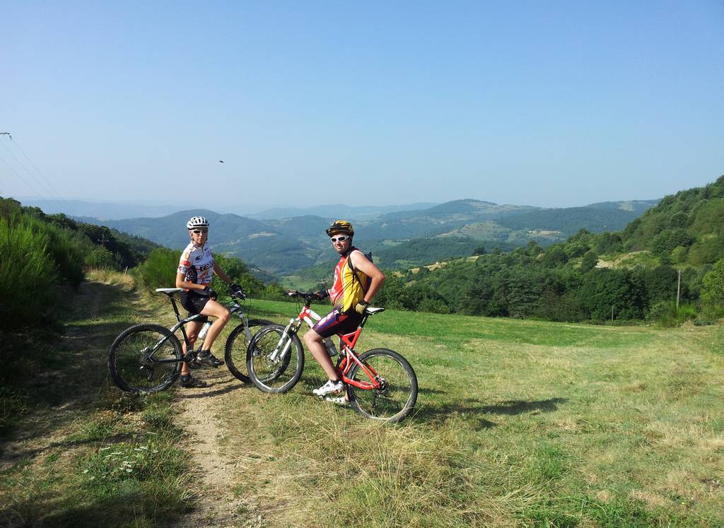
Rote MTB-Strecke gemäß der Bewertung der Fédération Française de Cyclisme.
Die Strecke beginnt mit einem gleichmäßigen Anstieg bis zum Montplot und seinem 360°-Panorama.Eine technische und steinige Abfahrt führt nach Saint-Félicien, bevor ein technisches und spielerisches Finale folgt.
Place du 8 mai 45 - BP70019
26601 Tain l'Hermitage CEDEX
Place du 8 mai 45 - BP70019
26601 Tain l'Hermitage CEDEX
Dienstag bis Samstagvormittag – 09:30-12:00 / 14:00-18:00 Uhr
Büro ausnahmsweise geschlossen am 6. April, 1. Mai, 8. Mai, 14. Mai und 25. Mai.
Hôtel de la Tourette - 2 Place St-Julien
07300 Tournon sur Rhône
Montag bis Samstag – 09:30-12:00 / 14:00-18:00 Uhr Feiertage: 09:00-13:00 Uhr
Büro ausnahmsweise geschlossen am 6. April, 1. Mai und 8. Mai.
32, avanue Georges Bert
26260 Saint-Donat-sur-l'Herbasse
Dienstag bis Samstagvormittag – 09:30-12:00 / 14:00-18:00 Uhr
Büro ausnahmsweise geschlossen am 6. April, 1. Mai, 8. Mai, 14. Mai und 25. Mai.
Place de l’hôtel de ville
07410 Saint-Félicien
+33(0)4 75 06 06 12
Büroeröffnung am 8. April 2026
Dienstag bis Samstagvormittag: 09:30-12:00 / 14:00-18:00 Uhr
Büro ausnahmsweise geschlossen am 1. Mai, 8. Mai, 14. Mai und 25. Mai.

