Büroeröffnung am 8. April 2026
Dienstag bis Samstagvormittag: 09:30-12:00 / 14:00-18:00 Uhr
Büro ausnahmsweise geschlossen 25. Mai.
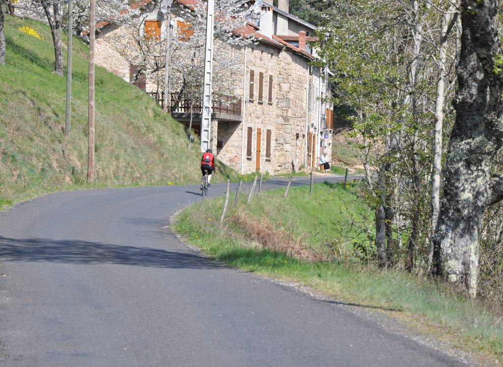
Radtour mit abfallendem Profil von Lalouvesc nach Tournon, die das gesamte Doux-Tal durchquert.
Unterwegs sollten Sie die charaktervollen Dörfer Désaignes und Boucieu le Roi nicht verpassen. Zum Schluss die majestätischen Gorges du Doux.
Die Strecke kann das ganze Jahr über selbstständig begangen werden.
Es besteht die Möglichkeit, mit dem Bus der Linie 11 von Tournon sur Rhône nach Lalouvesc aufzusteigen.
Place du 8 mai 45 - BP70019
26601 Tain l'Hermitage CEDEX
Place du 8 mai 45 - BP70019
26601 Tain l'Hermitage CEDEX
Dienstag bis Samstagvormittag – 09:30-12:00 / 14:00-18:00 Uhr
Büro ausnahmsweise geschlossen 25. Mai.
Hôtel de la Tourette - 2 Place St-Julien
07300 Tournon sur Rhône
Montag bis Samstag – 09:30-12:30 / 13:30-18:00
Sonn- und Feiertage : 09:00-13:00 Uhr
32, avanue Georges Bert
26260 Saint-Donat-sur-l'Herbasse
Dienstag bis Samstagvormittag – 09:30-12:00 / 14:00-18:00 Uhr
Außerordentlich geschlossen am 25. Mai sowie am Dienstag, den 30. Juni nur vormittags.
Place de l’hôtel de ville
07410 Saint-Félicien
+33(0)4 75 06 06 12
Büroeröffnung am 8. April 2026
Dienstag bis Samstagvormittag: 09:30-12:00 / 14:00-18:00 Uhr
Büro ausnahmsweise geschlossen 25. Mai.

